Know Your District
Senate District 19 Map
District 19 spans the East Mountains of Albuquerque, parts of Sandoval, Santa Fe, Bernalillo, and Torrance counties. Explore the official map below to see if your community falls within the district.
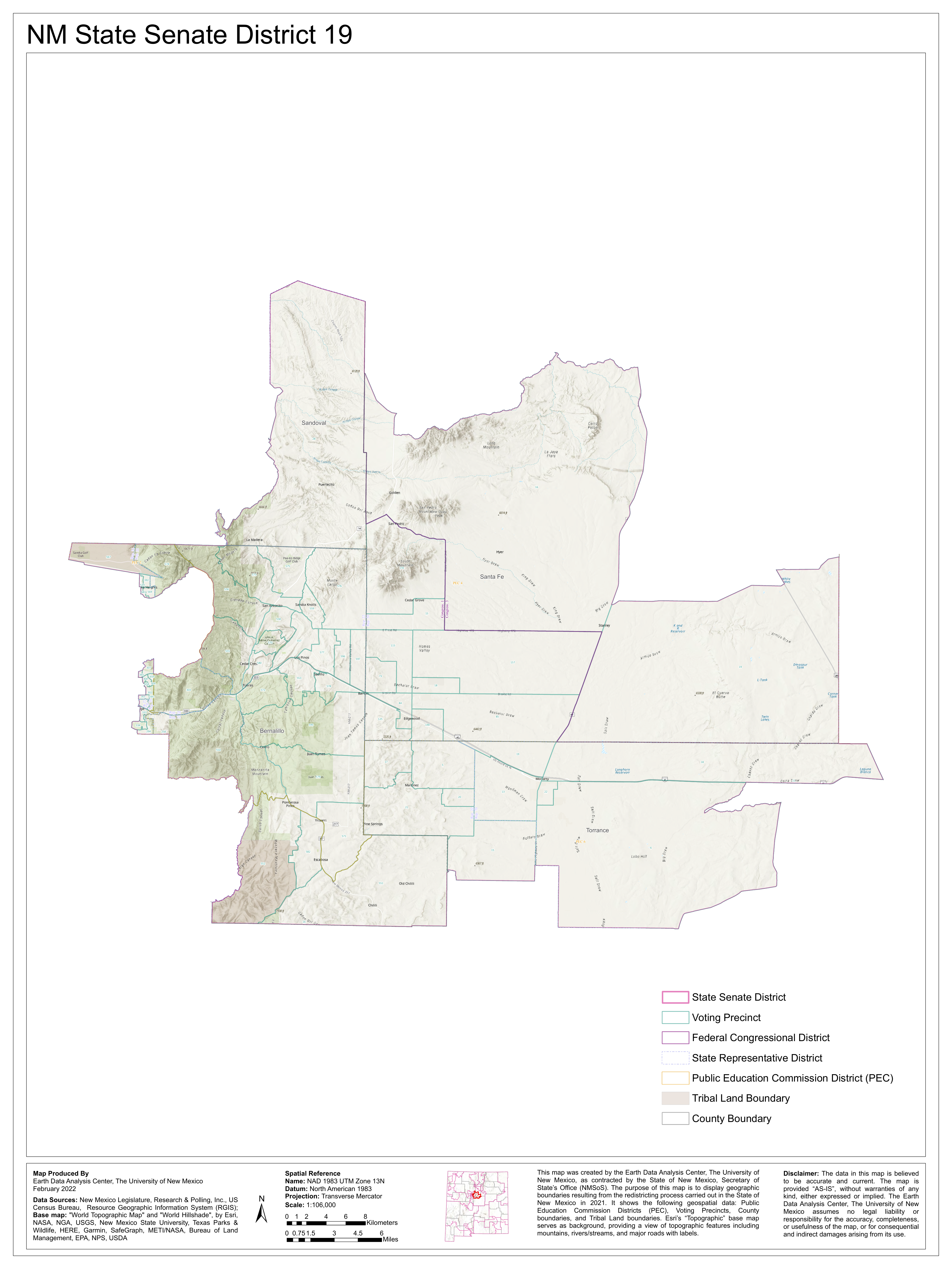
Map source: Earth Data Analysis Center, University of New Mexico (February 2022). Created using data from the NM Legislature, US Census Bureau, and Esri. Boundaries reflect the 2021 redistricting process.
Am I in District 19?
Enter your ZIP code or city name to check if you're in Senate District 19. For the most accurate results, include your 5-digit ZIP code.
District at a Glance
Population
~62,000 residents
Counties
Bernalillo, Sandoval, Santa Fe, Torrance
Geography
East Mountains & Estancia Valley
Communities in District 19
Live in District 19?
Your vote shapes the future of the East Mountains. Learn where Ant stands on the issues that matter to your family.